The Terrain of Takegashima
The Checkpoint from the Nansei Islands to Honshu
Takegashima is not well known as an ancient holy place. Because it was a small island in Shikoku far from any people, this place was probably quietly protected to this day from the outside world. Although this small island just looks like an ordinary island, the reason why Takegashima secretly attracted the attention from travelers in ancient times is due to its unique topography and the scenery of the island could be seen from the seaside.
In the distant past, many of the ancients who came to the Japan archipelago from Asia traveled north to the Nansei Islands, mainly from Taiwan via the Ryukyu Islands, by ship. Sailors who arrived from Kyushu to Awaji Island and Honshu via the southern coast of Shikoku, established bases throughout the archipelago, initially sailing around the archipelago from the Setouchi Sea. The seafaring skills of the seamen were brought from the distant Asian continent, more specifically the West Asian region.
 Awaji Island, the final destination of the sailors’ voyage to the Japan archipelago, was considered the center of the Japan archipelago in ancient times. This is because, not only is it clearly stated in the book KIKI that Awaji Island was the starting point of the nation's birth, but it is also geographically located in the center of the Japan archipelago. In addition, the archipelago along the Kuroshio Current in the Nansei Islands ended at Awaji Island, and since it was impossible to sail north from there, Awaji Island was the final destination of the "islands of the sea" on the Kuroshio Current. Needless to say, for migrants traveling north from the Nansei Islands to Awaji Island, the voyage route from the southern coast of Kochi Prefecture to the north from the Kii Channel to Awaji Island via the east coast of Shikoku has been regarded as an important route.
Islands used as Landmarks for Navigation in the Kii Channel
Ancient sailors continued their voyages using many landmarks that could be seen from the sea, confirming the movement of celestial bodies. Among these indicators, Cape Muroto in Shikoku was especially important. In the direction of the summer solstice sun rising from Cape Muroto is the summit of Mt. Fuji. And on the line connecting these two bases, Cape Irago, Ise Jingu Inner Shrine, and Odaigahara are lined up. In addition, from Cape Muroto to the direction of about 240 degrees when the sun sets on the winter solstice, Cape Ashizuri and Sakurajima Mitake in Kagoshima are lined up. Consequently, starting from Cape Muroto, the direction and positioning of other bases in the archipelago was confirmed by (name). For ancient voyagers who traveled while studying celestial bodies and topography, Cape Muroto was an important destination.
When heading north from Cape Muroto, it is thought that the next useful landmark was Ishima, which floats at the easternmost tip of Tokushima. From Ishima, you can not only see Awaji Island, but also see the summit of Shikoku Kenzan, the second highest mountain in West Japan, in the distance, and the mountains of Kumano to the east. Also, due north of Ishima Japan there is the stone treasure hall of Ikuishi Shrine, which is said to be one of the three wonders. It is possible that the location of the Ikuishi Shrine was found linked to Ishima. If you sail along the coast from Cape Muroto to Ishima, both bases are nearly 100 km, but since the route connecting to the Kii Channel has a good view, sailors frequently traveled this route from the Kochi coast to Setouchi and via Awaji.
The sacred island surrounded by beautiful boulders
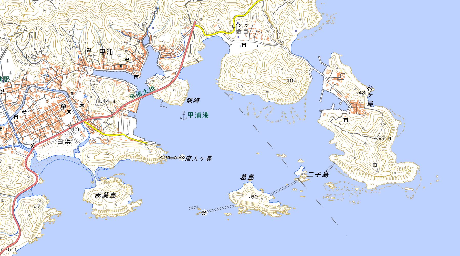
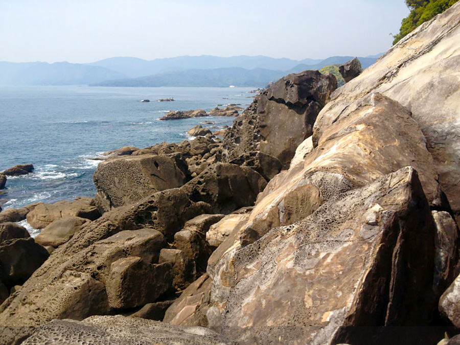 North along the Pacific coast of Kochi and Tokushima prefectures, Takegashima Island is visible 35 km north of Cape Muroto. The Pacific coast of Kochi Prefecture, which begins at Cape Muroto, has a series of ordinary coastline scenery. However, as you get closer to the shoreline around Takegashima, you can see that the scenery changes completely. Suddenly, the peaceful coastal landscape transforms into an island surrounded by rocky rocks made of megaliths. Moreover, from the top of the island, at an altitude of about 100 meters, you can see Cape Muroto, Ishima, and even the mountains of Kumano in the distance. As an ancient observatory, it must have taken notice of the ancients, given its perfect position.
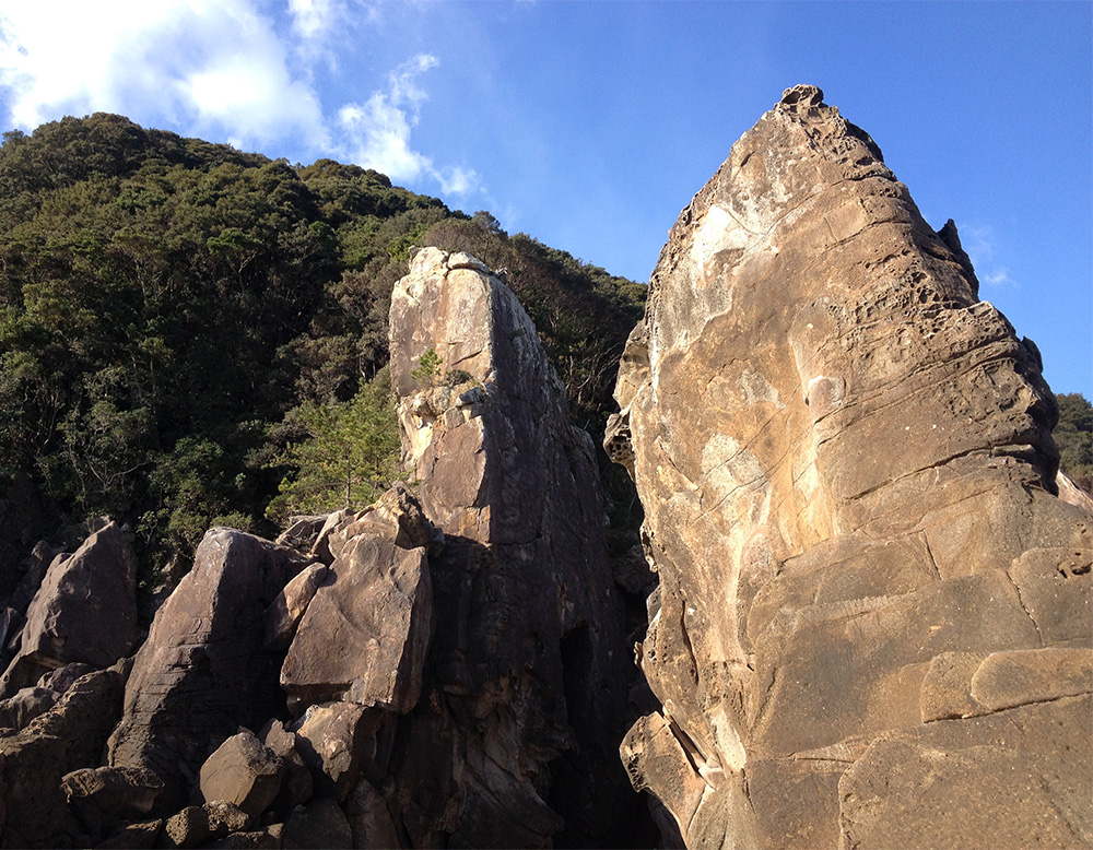
The wharf of Takegashima is supported by a spread of geological formations called the Shimanto Formation, which are distributed not only in the south of Shikoku but also along a wide Pacific coast from Kyushu to Kanto. The strata are formed by turbidites, where sediments on the seabed flow like landslides. Turbidite is thought to be formed by the collection of accretions that detach from rocks when oceanic plates sink about 4 cm below continental plates every year. On Takegashima Island, alternating mudstone and sandstone layers can be seen throughout the coast of the island. On the east shore of Takegashima, which was nurtured by these 40,000 strata, rocks rose and revealed the appearance of megaliths.
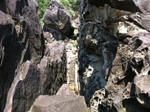 The appearance of Takegashima changes drastically from the coastline and continues from Cape Muroto. It has the appearance of an island formed by megaliths big enough to be worthy of being called a rock island, so travelers traveling by boat in the nearby seas must have been able to see it easily in the distance. Megaliths like the ones found on the eastern coast of Takegashima Island along with turbidite formations did not exist on the voyage route from the Nansei Islands to Awaji Island. Therefore, it is thought that Takegashima, which floats on the way north from Cape Muroto to Awaji Island, has come to be worshipped as a holy island implicitly.
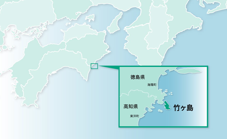
The detai MAP
Source: The Japan map of Geospatial Information Authority